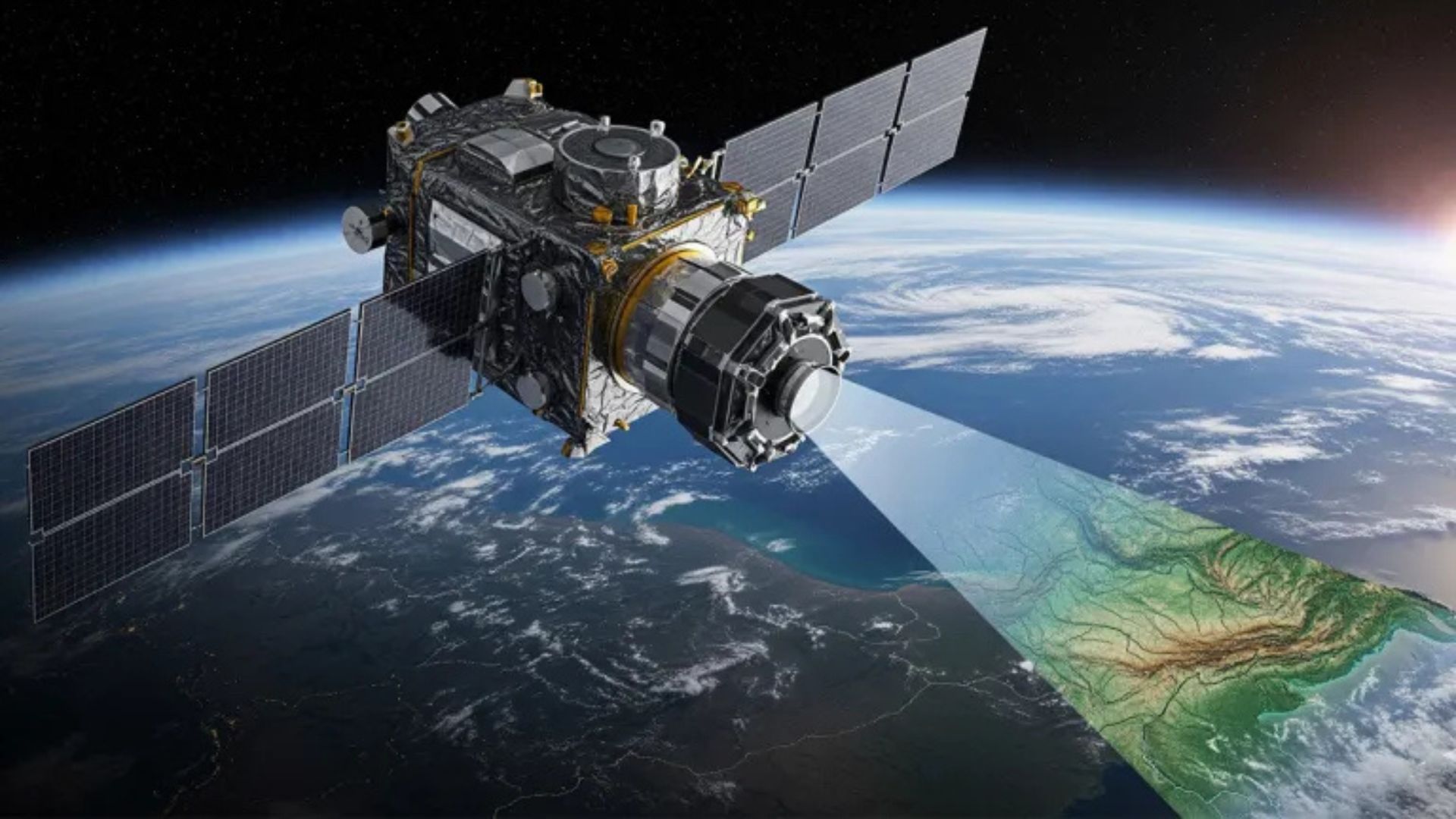

A defense technology firm just pulled back the curtain on something straight out of a spy movie: a live, AI-powered digital twin of the entire Earth. Aechelon Technology, a leader in military simulations, announced Project Orbion on September 8. The company is teaming up with tech heavyweights like Niantic Spatial and ICEYE to build what it calls the first-ever live digital replica of our planet. This ambitious system merges real-time satellite images, advanced radar, and AI to create a constantly updating 3D model. Its superpower? The ability to see through clouds, smoke, and even darkness, offering a clear view of anywhere on the globe for everything from disaster relief to defense missions.
So, how are they pulling this off? Project Orbion is a massive team effort, with each partner bringing a crucial piece of the puzzle. Niantic Spatial, known for its geospatial mapping, is in charge of building and visualizing the 3D world. Meanwhile, Finland’s ICEYE contributes powerful radar that can see in any condition, BlackSky provides ultra-sharp satellite photos, and Distance Technologies supplies advanced 3D displays. Nacho Sanz-Pastor, Aechelon’s CEO, says his company has spent decades perfecting virtual worlds for training and described the new project as tackling real-world problems that “until now were just in the realm of science fiction.”
The real-world applications are where this technology truly shines, serving both military and civilian needs. Imagine firefighters getting a live, unobstructed 3D view of a wildfire’s spread or emergency teams tracking floodwaters in real time. For defense, it could mean monitoring troop movements or securing shipping lanes with unprecedented clarity. One of the most groundbreaking features is its ability to provide centimeter-accurate navigation even when GPS is down—a potential game-changer for search-and-rescue teams operating in dangerous and remote environments.
“By combining our platform to scan, visualize and understand the world with Aechelon’s simulation technology, we can provide emergency and first responders the most accurate understanding of the environments in which they operate,” explained Brian McClendon, the Chief Technology Officer at Niantic Spatial. In short, the goal is to give people on the front lines a powerful digital tool to make critical decisions faster and more safely.
Aechelon isn’t the only player in this high-stakes race to map the world. Project Orbion is stepping into a field where giants are already at work. Google’s DeepMind is developing AlphaEarth Foundations for detailed surface mapping, and the European Union’s Destination Earth initiative is building its own digital twins to model climate change. But Aechelon has a long history in this space; founded in 1998, the company is a veteran provider of flight simulators for militaries worldwide and recently received a major investment from Sagewind Capital, giving it the fuel to turn this science fiction concept into reality.